
Convert FIT to GPX when you need the recorded route from a supported fitness activity in a more widely readable track format. The FIT to GPX converter checks the FIT data with CRC validation, selects records that contain GPS coordinates, and downloads a GPX track with supported elevation and timestamps. The preview shows how many records supplied positions and how many were omitted. Keep the original FIT for sensor data and workout detail, because this GPX export intentionally retains only the supported route subset.
How to convert FIT to GPX
- Choose an activity file ending in
.fit. FIT is binary, so there is no text-paste substitute for the original bytes. - Select Process files, or use Try an example to inspect the bundled small route sample.
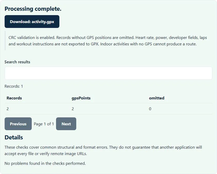
- Review the total record count, GPS-point count and omitted-record count.
- Download
activity.gpxand check the track in a compatible application.
The FIT to GPX converter does not sign in to a training service or import directly into a device. Export the authorized activity file from your source application first, preserving the original in case you need information beyond the route.
Which FIT information reaches the GPX track?
Records with finite latitude and longitude values become track points. Supported altitude values and timestamps are added when available; enhanced altitude is preferred over the ordinary altitude field. Records without GPS positions are omitted rather than assigned an invented location.
Heart rate, cadence, power, developer fields, laps and workout instructions are not exported by this FIT to GPX converter. Those fields may exist in the FIT source, but this implementation does not write them as GPX extensions. A GPX route is therefore not a full backup of your fitness session. Retain the FIT whenever detailed activity analysis or device-specific data matters.
Worked example: two GPS records and one omitted record
Suppose a decoded activity contains three records: two with valid positions and timestamps, and one sensor record without a position. The route export includes two GPX track points, and the preview reports one omitted record. It does not create a third point between the other two merely to match the source record count.
A point with latitude 37.8, longitude -122.4, altitude 10 and a recorded UTC timestamp is represented through the GPX point attributes and supported child values. This is a conceptual example of the exported subset; use the bundled binary example for an actual processing test.
Indoor activities, course files and damaged downloads
An indoor activity may contain rich sensor data but no GPS route. In that case, this FIT to GPX converter cannot produce a useful track and reports the missing usable coordinates. A FIT course or workout file is not automatically equivalent to an activity record stream; this tool is designed around supported recorded-position data.
CRC validation is enabled. If parsing fails, obtain a fresh copy from the source rather than disabling integrity checks or renaming another binary file to FIT. A failed export may be truncated or use data outside the supported parser profile. The converter does not repair arbitrary binary corruption.
Check privacy before sharing a route
GPS activity files can reveal homes, workplaces and repeated routines even when names have been removed. Processing happens in your browser, but a GPX download still exposes the coordinates and supported times that were deliberately preserved. Examine the beginning and end of the route before sharing it publicly.
The GPX repair tool can perform its documented coordinate and field cleanup, but repairing a file is not a privacy guarantee. Plan any location trimming in a workflow that actually supports it, and inspect the resulting route rather than assuming that changing the format anonymized your activity.
Choose conversion according to the destination task
Use GPX when the destination needs a track path, supported elevation and timing. Keep FIT when the destination can read it and you need training detail. Garmin’s FIT overview describes the format’s broader activity, course and workout uses, which exceed this route extraction.
For a different source activity format, the TCX to FIT converter writes a separate, limited activity profile. For Google Earth-style geographic data, the KML to GeoJSON converter targets map geometries rather than fitness sensors. Select the format and conversion direction your intended application actually accepts.
Review the generated track before use
Open the GPX in your intended application and inspect several known points, the route endpoints and any available timestamps or elevations. Applications differ in how they calculate distance, smooth elevation or display gaps, so an import may not reproduce every statistic from the source training service.
The converter bounds the GPS-point count and uses the displayed file-size limit to protect browser resources. Oversized activities may need a smaller authorized export. Keep the original FIT until you have confirmed the track is useful, and clear the page on a shared device. The result is a supported route conversion, not device-import certification or medical/training advice.
Common FIT to GPX converter errors and how to fix them
When the FIT to GPX converter cannot use a file, it stops with one clear message instead of producing a half-finished download. These are the problems people run into most often, with the fix for each:
- The FIT file failed parsing or checksum validation. The CRC does not match, usually from an incomplete sync or a damaged copy. Download the activity again.
- A GPS coordinate or elevation is invalid. No record contains GPS positions, as with treadmill or trainer activities.
- Heart rate, power or laps missing from the GPX The output is a GPS track; those fields are not exported.
Privacy: the FIT to GPX converter runs in your browser
FIT to GPX converter processing happens with JavaScript in a background worker on this page. Your file is not uploaded to a FileFix server, and the results you download are created in your browser’s memory. Activity and location files reveal where you live, train and travel, so they are worth keeping on your own device. When you finish on a shared computer, clear the selection or close the tab.
For the underlying format rules, see the GPX 1.1 schema. The FIT to GPX converter follows the subset described on this page rather than every optional feature in those documents.
Want the numbers rather than a route? The FIT to CSV converter exports each record row with time, position, heart rate and more.
Sources
Questions about this tool
Will heart rate and power remain in the GPX?
No. This converter exports recorded GPS points with supported elevation and timestamps; it does not write fitness sensor extensions.
Can I convert an indoor FIT activity with no GPS?
Not into a useful route. Records without positions are omitted, and a file with no usable GPS points cannot produce this GPX output.
Does the tool validate FIT integrity?
CRC validation is enabled in the parser. A damaged or unsupported binary file can be rejected rather than exported with guessed data.
Are omitted records replaced with interpolated positions?
No. The converter does not invent locations or interpolate missing GPS records.
Does converting to GPX anonymize my activity?
No. The route and supported timestamps remain. Inspect location privacy before sharing the downloaded file.
Review the supported formats and limitations before using an output file. File processing happens in your browser.